Mt. Wilson from Bailey Cyn
 BAILEY CANYON WILDERNESS PARK TRAIL TO MT. WILSON
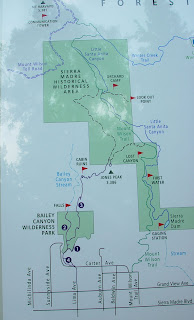
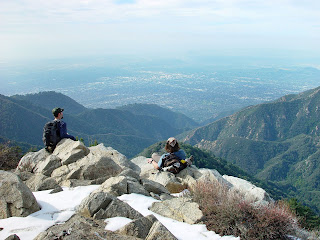
From Bailey Canyon Wilderness Park to Jones Peak summit is 6.6 miles round trip with a2,275′ gain; return via Mt. Wilson Trail is 8 miles round trip with 2,500′ gain. When the light is right and the air is clean, the purple mountains beckon with the sweet smell of sage and many a winding trail. One of these inviting trails leads up Bailey Canyon from the town of Sierra Madre.The attraction is the view: clear day vistas of the San Gabriel Valley are your reward for scaling many a steep switchback. There are two significant splotches of green almost due south of the canyon: the Los Angeles County Arboretum and the Santa Anita Golf Course. Between the green is Santa Anita racetrack.
In 1875, this canyon on the outskirts of Sierra Madre was homesteaded by R.J. Bailey, who left little behind but his name. Over the years the property was divided. The Sierra Madre Municipal Water Company acquired part of the canyon, as did the Passionisi Fathers, who built a monastery. The Carter family owned the lower part of the canyon and in 1965 donated land to the city of Sierra Madre for Bailey Canyon Park. For quite some time, the path leading up BaileyCanyon was known as the Carter Trail.
The trailhead is located at the city of Sierra Madre’s Bailey Canyon Wilderness Park, which offers picnic areas and interpretive displays, as well as an easy family outing on two nature trails—Live Oak and Canyon View. Little known and little chronicled, Jones Peak offers terrific clear day views from its 3,375′ summit. Vistas include Mt. Wilson to the north, Mt. San Jacinto to the east, the Pacific and Catalina Island to the south.
DIRECTIONS TO TRAILHEAD: From the Foothill Freeway (210) in Arcadia, take the Rosemead Blvd./Michillinda exit and head north on Michillinda. Continue a bit more than a mile to Grand View Avenue, turn right and proceed a few blocks to Grove Street. Follow Grove to its end at Bailey Canyon Wilderness Park, where youll find ample parking.
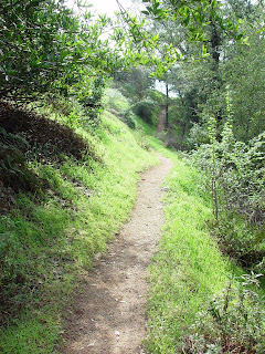
THE HIKE: From the west end of the parking lot, head out on to the trail. You’ll pass an ancient pedestrian gate with an old turnstile and head north on the paved service road, which transitions to a trail. A quarter mile from the trailhead, look for Live Oak Nature Trail meandering off to the right; the interpretive path offers a short and easy loop around numbered posts. After another 0.1 mile, the trail splits, with the left fork (CanyonView Nature Trail) leading to a seasonal waterfall. Bailey Canyon Trail begins a no-nonsense climb and, after a couple of switchbacks, it’s goodbye shade, hello steep ascent. Many a switchback takes you up the steep, brushy, east wall of the canyon and then north, higher and higher into the San Gabriel Mountains. The shadeless ascent leads to a saddle on the north side of Jones Peak. Head south (right) up the steep summit trail to the top of the peak.

Categorised as: Uncategorized










Leave a Reply
You must be logged in to post a comment.